Oxford Land
Find interactive atlases, maps and land registries from OnLand, the Ontario Historical County Map Project by the University of Toronto and the McGill University Map Project.
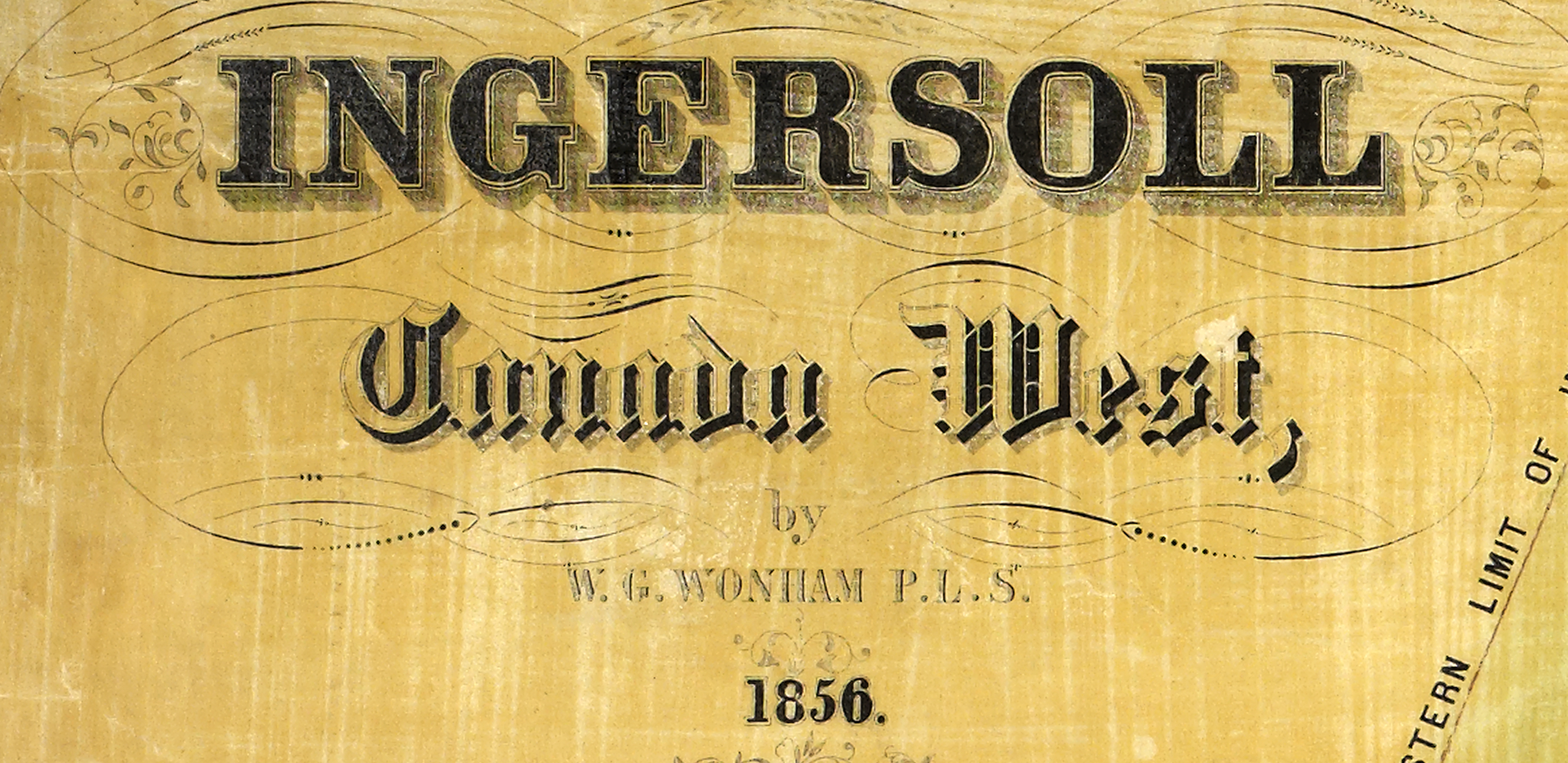
1856 Ingersoll Survey Map
Prepared by surveyor, William G. Wonham (1820-1887), this map captures Ingersoll just after its birth as a town in 1852. Lithography by J. Sage & Sons, Buffalo, NY. From the collection of the Archives of Ontario.
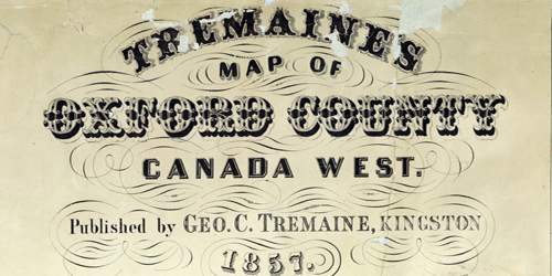
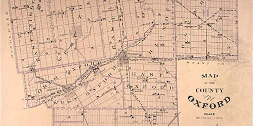
1857 Tremaine's Map of Oxford County
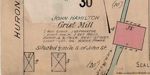
Tremaine's map of Oxford County, Canada West was published in 1857. The map Includes 34 views of commercial, residential, and public buildings; legend keys four types of mill, plank and gravel roads, railways and post offices; names of owners and/or tenants shown in lots; subscribers directory; list of officers and clerks of the division courts. Towns and villages at larger scales.
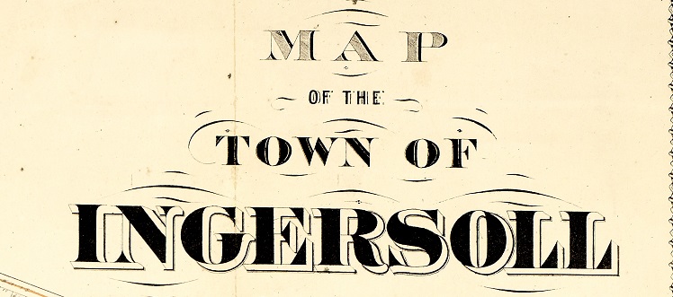
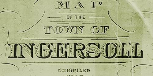
1874 Ingersoll Survey Map
Prepared by William G. Wonham (1820-1887) under the provisions of the Register of Titles Ontario Act, August 20, 1874. From the collection of the Archives of Ontario.
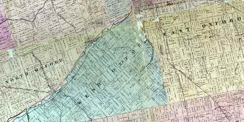
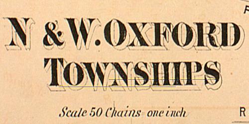
1876 Ingersoll, North & West Oxford Township map
This map from the Ontario Historical Atlas, shows land pioneers in the region around Ingersoll
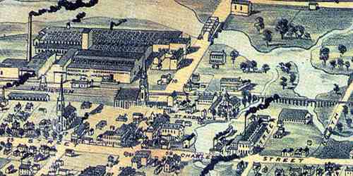
1887 Ingersoll Bird's-Eye Map
Sketched and lithographed by J. C. Young Publishing, this map depicts an aerial view of Ingersoll in 1886.
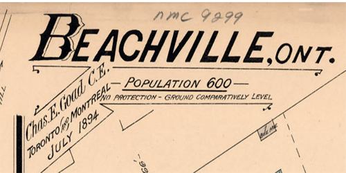
1894 Beachville Fire Insurance Map
Produced by Charles E. Goad in July 1894 this map details structures, streets, business names.
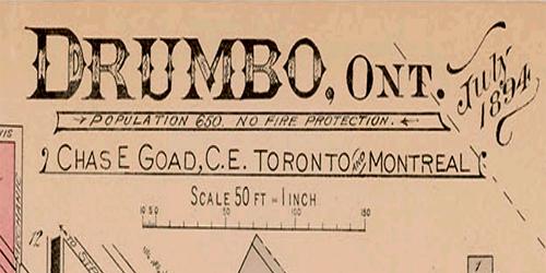
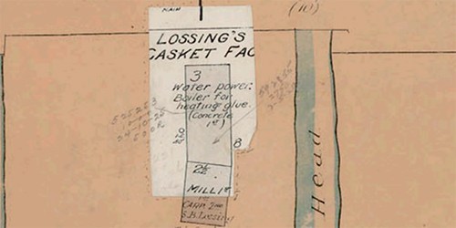
1894 Drumbo Fire Insurance Map
Produced by Charles E. Goad in July 1894 this map details structures, streets, business names.
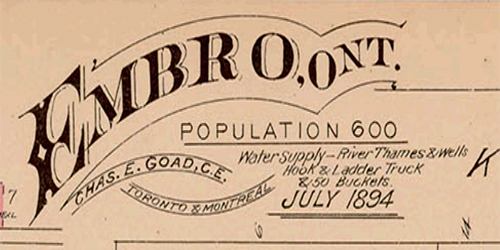
1894 Embro Fire Insurance Map
Produced by Charles E. Goad in July 1894 this map details structures, streets, business names.
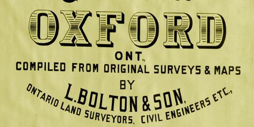
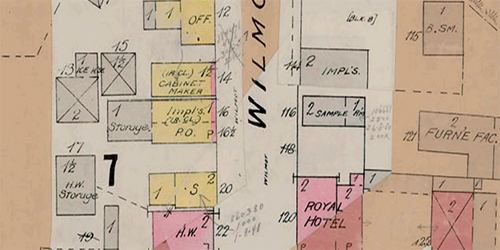
1896 Bolton's New Map of Oxford County
Prepared by L. Bolton & Son of Listowel, land surveyors & civil engineers. Contains property owner names.
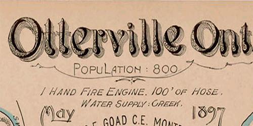
1897 Otterville Fire Insurance Map
Produced by Charles E. Goad in May 1897 this map details structures, streets, business names.
1904 Beachville Fire Insurance Map
Produced by Charles E. Goad in July 1904 this map details structures, streets, business names.
1904 Drumbo Fire Insurance Map
Produced by Charles E. Goad in July 1904 this map details structures, streets, business names.
1904 Embro Fire Insurance Map
Produced by Charles E. Goad in July 1904 this map details structures, streets, business names.
1904 Otterville Fire Insurance Map
Produced by Charles E. Goad in July 1904 this map details structures, streets, business names.
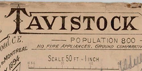
1904 Tavistock Fire Insurance Map
Produced by Charles E. Goad in July 1904 this map details structures, streets, business names.
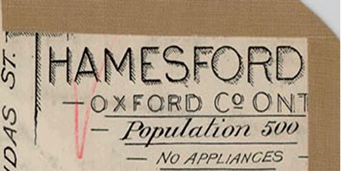
1904 Thamesford Fire Insurance Map
Produced by Charles E. Goad in July 1904 this map details structures, streets, business names.
1905 Ingersoll Survey Map
On the order of the town council, this map was prepared by F. J. Ure and details streets, surveys and lots.
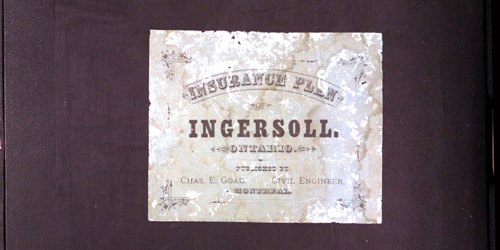
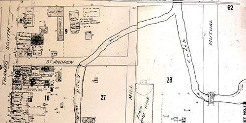
1913 Ingersoll Fire Insurance Map
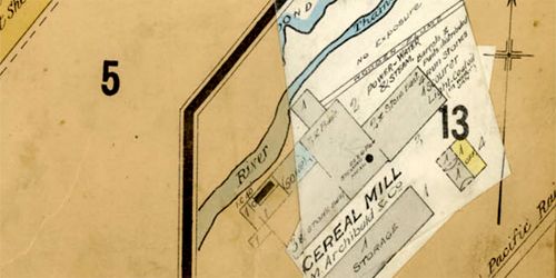
Produced by the Charles E. Goad Co. in June of 1913 this detailed map shows the core area of Ingersoll, size, shape and construction materials of dwellings, commercial buildings, factories and other structures.
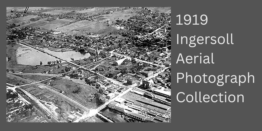
1919 Ingersoll Aerial Photograph Collection
Produced, printed and copyrighted from 1919 to 1920 by Bishop Barker Company, these aerial images represent an attempt by ex-flying aces from the First World War to transfer their military skills into a postwar living.
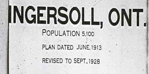
1928 Ingersoll Fire Insurance Map
Published by the Underwriters Bureau in September 1928, this map provides a detailed map of Ingersoll.
1932 Ingersoll Fire Insurance Map
Detailed information about business and structures
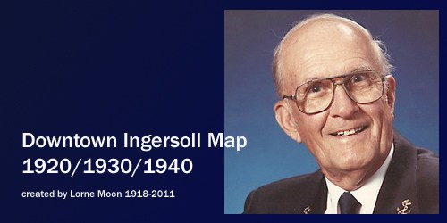
Ingersoll Downtown map 1920-1940
Created by Lorne Moon, this map details business & industry between the wars.
McGill University Map Project
The County Atlas project includes digitized county maps and searchable information on ca. 140,000 people living in Ontario counties during the 1880s.
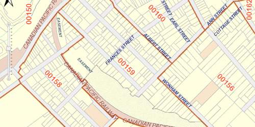
OnLand
OnLand is your online information source from the Ontario Land Registration and Writs system.
Ontario Land Records Index 1780-1920
Compiled by the Archives of Ontario, this name searchable index has been adapted to include only Oxford County settlers.
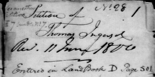
Oxford County Land Petitions : 1763-1865
A database of over 500 early pioneers, containing completely digitized land grant petitions.
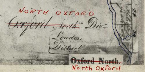
Oxford Land Patent Plan Maps 1820-1851
Discover this visual resource as an aid to trace your ancestors’ Crown land records. These maps show the status of Crown lands in Oxford County, whether patented, leased, or under a license of occupation.
Research Oxford County Farm History
In this step-by-step tutorial, discover how to use OnLand.ca to research the history of your farm or property.

Research Oxford County House History
In this step-by-step tutorial, discover how to use OnLand.ca to research the history of your home or property.
U of T Historical County Map Project
1857 Tremaine's map overlaid with modern GIS mapping technology and satellite imagery allows researchers to discover ancestral land.